Tomorrow Wednesday, a big storm named Ciarán will form over the Atlantic under rapid strengthening, which will subsequently move over southern England to the North Sea during the night on Thursday and on Thursday, bringing gale-force winds of up to about 150 km/h in parts, especially in southern England and northern France, and here especially in Brittany. Associated with this are also in the western English Channel and on the west coast of France also high waves of over 10 meters in places.
Interim balance in the morning
Over the last few hours, bomb cyclone Ciarán has moved further east and now lies roughly over the Isle of Wight with a core pressure of around 955hPa. As the day progresses, Ciarán will gradually move on into the North Sea and slowly weaken. The strongest wind peaks were recorded in Brittany (see ticker entry below), since early this morning the top-20 list has only changed cosmetically:
Strongest wind gusts (as of 07:36)
| Measuring stations | Strongest wind gusts (in km/h) |
|---|---|
| Pointe du Raz (67 a.s.l.) | 207 |
| Île-de-Batz (32 a.s.l.) | 195 |
| Plougonvelin (22 a.s.l.) | 192 |
| Brignogan-Plage (9 a.s.l.) | 190 |
| Ushant (64 a.s.l.) | 185 |
| Penmarch (3 a.s.l.) | 177 |
| Île de Bréhat (25 a.s.l.) | 175 |
| Ploudalmézeau (40 a.s.l.) | 171 |
| Lanveoc Poulmic (81 a.s.l.) | 170 |
| Fécamp (104 a.s.l.) | 169 |
| Île d'Groix (41 a.s.l.) | 167 |
| Gouville-sur-Mer (7 a.s.l.) | 167 |
| Cap de la Hève (100 a.s.l.) | 166 |
| Ploumanac'h (55 a.s.l.) | 166 |
| Landivisiau (109 a.s.l.) | 162 |
| Plovan (10 a.s.l.) | 162 |
| Saint-Ségal (89 a.s.l.) | 162 |
| Lannion (85 a.s.l.) | 157 |
| Barneville-Carteret (62 a.s.l.) | 157 |
| Pointe de Beg-Meil (8 a.s.l.) | 157 |
Here is another visual representation of the wind station. An always up to date version is available on our measured values web page. Here for France and here for Great Britain.
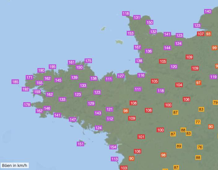
Fig. 1: Maximum wind gusts France; Source: MeteoNews
Second strongest wind gust in France
According to preliminary data, the second strongest wind gust in the measurement history of France was recorded in Pointe du Raz with 207 km/h. The absolute record is 216 km/h and was recorded in connection with "The Great Storm" in 1987 at the same measuring station. Among others, new station records were set in Ile-de-Batz, Lanvéoc, Saint-Segal and Brest.
Le pic d'intensité a été atteint sur #Finistère (sauf sur l'extrême nord du département) et le #Morbihan.
— Keraunos (@KeraunosObs) November 2, 2023
Sur le Finistère, toutes les stations dépassent 130 km/h, plus de 80% dépassent les 150 km/h.
Episode moindre sur le Morbihan mais localement intense. #Ciaran pic.twitter.com/vK2eQVbeSZ
Impressive pressure curve
The example of St. Mary's on the Isles of Scilly illustrates the rapid pressure drop during the passage of Ciarán. Here, the air pressure dropped from about 990hPa to about 955hPa within less than 12 hours.
Wow! Storm Ciarán’s center just passed directly over the Isles of Scilly, UK which recorded a minimum pressure of 955.7 hPa. pic.twitter.com/pfDs7nQkgN
— Nahel Belgherze (@WxNB_) November 2, 2023
Possible tornado in Jersey
A few hours ago, a tornado possibly occurred in Jersey (Channel Islands). In the darkness, however, this can not be proven without a doubt.
A tornado has touched down in Jersey, Channel Islands with damage being reported. pic.twitter.com/8UkVrcq6gT
— Nahel Belgherze (@WxNB_) November 2, 2023
Meter high waves on the coast
A webcam on the Sidmouth Coast shows the huge waves on the coast.
Impressive waves slamming the Sidmouth coast moments ago.#StormCiaran #Ciaran #UK pic.twitter.com/k7R6wqRXVT
— StormHQ ☈ (@StormHQwx) November 1, 2023
Wind peaks over 200 km/h!
The center of storm Ciarán is now over the English Channel, its core pressure is 955 hPa. In Brittany, the wind has increased further, a peak gust of 207 km/h was recorded at the station Pointe du Raz!
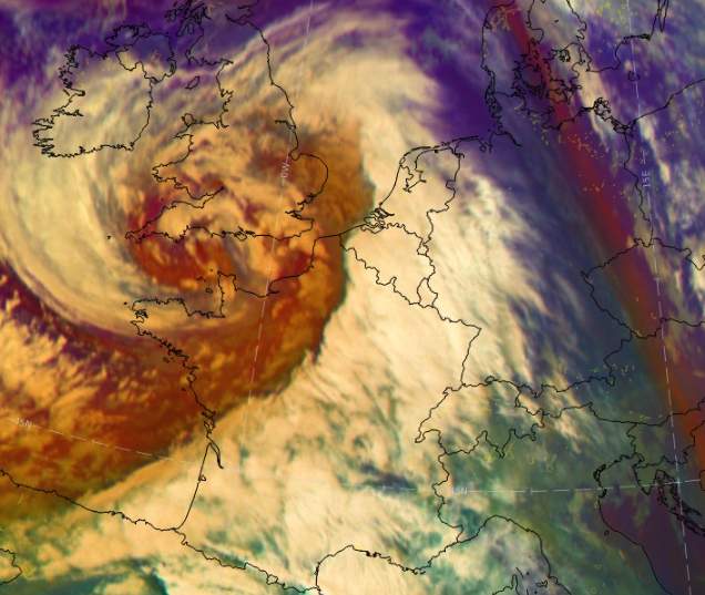
Fig. 1: Position of the hurricane low at 05:00 Thursday morning; Source: MeteoNews, Ubimet
Strongest wind gusts (as of 05:06)
| Measuring stations | Strongest wind gusts (in km/h) |
|---|---|
| Pointe du Raz (67 a.s.l.) | 207 |
| Île-de-Batz (32 a.s.l.) | 195 |
| Plougonvelin (22 a.s.l.) | 192 |
| Brignogan-Plage (9 a.s.l.) | 190 |
| Ushant (64 a.s.l.) | 185 |
| Penmarch (3 a.s.l.) | 177 |
| Ploudalmézeau (40 a.s.l.) | 171 |
| Lanveoc Poulmic (81 a.s.l.) | 170 |
| Île d'Groix (41 a.s.l.) | 167 |
| Île de Bréhat (25 a.s.l.) | 165 |
| Gouville-sur-Mer (7 a.s.l.) | 162 |
| Landivisiau (109 a.s.l.) | 162 |
| Plovan (10 a.s.l.) | 162 |
| Saint-Ségal (89 a.s.l.) | 162 |
| Ploumanac'h (55 a.s.l.) | 159 |
| Barneville-Carteret (62 a.s.l.) | 157 |
| Pointe de Beg-Meil (8 a.s.l.) | 157 |
| Brest (94 a.s.l.) | 155 |
| Pointe de Chémoulin (14 a.s.l.) | 154 |
| Larrau (1427 a.s.l.) | 152 |
Gusts up to 170 km/h shortly before midnight
At the measuring station Pointe du Raz the highest wind peaks have been measured so far, the maximum gust reached 169 km/h. These are heavy gale-force winds that can cause massive damage to infrastructure! In the well-known port city of Brest with about 140,000 inhabitants, the gusts reached up to 130 km/h so far. In the next 2 to 3 hours the wind will increase a bit, after that the peak in Brittany will be reached.
Strongest wind gusts (as of 23:30)
| Measuring stations | Strongest wind gusts (in km/h) |
|---|---|
| Pointe du Raz (67 a.s.l.) | 169 |
| Plougonvelin (22 a.s.l.) | 148 |
| Ushant (64 a.s.l.) | 142 |
| Cerisy-la-Salle (134 a.s.l.) | 140 |
| Belle-Île/Point du Talut (34 a.s.l.) | 134 |
| Saint Sauveur/Île d'Yeu (32 a.s.l.) | 131 |
| Plovan (10 a.s.l.) | 130 |
| Brest (94 a.s.l.) | 129 |
| Pointe de Chémoulin (14 a.s.l.) | 129 |
| Gatteville-le-Phare (4 a.s.l.) | 128 |
| Barneville-Carteret (62 a.s.l.) | 128 |
| Penmarch (3 a.s.l.) | 126 |
| Dinard (65 a.s.l.) | 124 |
| Aiguille du Midi (3845 a.s.l.) | 122 |
| La Hague (6 a.s.l.) | 118 |
| Île d'Groix (41 a.s.l.) | 117 |
| Île-de-Batz (32 a.s.l.) | 110 |
| Pointe de Beg-Meil (8 a.s.l.) | 110 |
| Saint-Clément-des-Baleines (10 a.s.l.) | 109 |
Below also a few impressions of X contributions.
Ça souffle déjà très fort dans le #Morbihan, ici à Larmor plage. Et il est à peine 20h. #Ciaran pic.twitter.com/0i5vKGc7TF
— Isa Rettig (@isa_rettig) November 1, 2023
Ah ouais c’est violent la tempête #Ciaran là pic.twitter.com/3MKAnu5LkP
— Remy-kun (@_OGC_1) November 1, 2023
The seafront in Devon is starting to fill up rapidly. #StormCiaran will hit the coast with full force in a few hours#StormCiaran #Ciaran #France #UnitedKingdom pic.twitter.com/ltOk0A0Owm
— Trends on X (@X_TrendsX) November 1, 2023
Almost 150 km/h in Brittany
Storm Ciarán has strengthened rapidly over the Atlantic in the last hours. The air pressure in the center of the low is currently around 960 hPa. According to the latest calculations, the low is likely to strengthen further and reach a minimum air pressure of 952 hPa when it arrives at the south coast of England in the morning on Thursday (see Fig. 1).
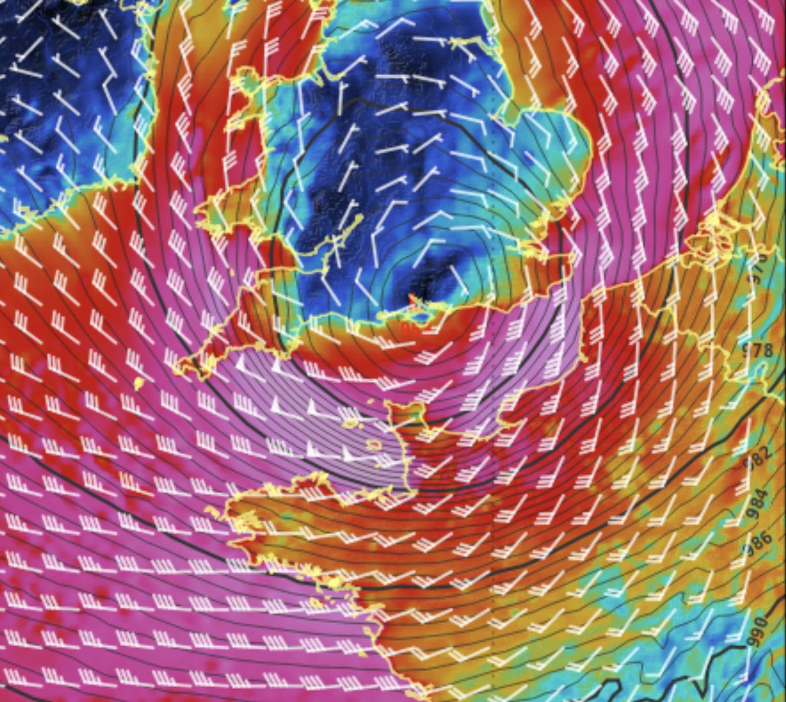
Fig. 1: Storm Ciaran hits the south coast of England in the morning on Thursday with a core pressure of about 952 hPa.; Source: MeteoNews AG / UBIMET
In Brittany - in the northwest of France - the storm is currently raging with wind peaks up to nearly 150 km/h. The following map shows the maximum wind peaks of today until 22:00. The continuously updated measured values can be accessed on the measured values page for France.
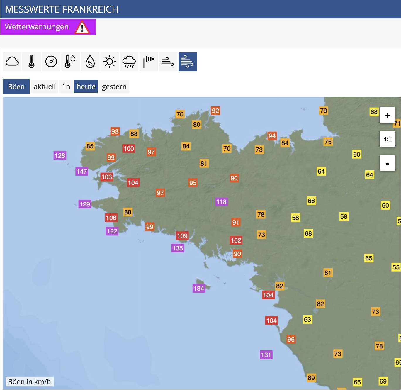
Fig. 2: Maximum wind peaks until 22:00; Source: MeteoNews
Storm peak in the night to Thursday
Currently, the storm is located about 300 kilometers off the coast of Brittany and about 300 kilometers south of Ireland over the Celtic Sea (see Fig. 2). The maximum wind peaks reach up to 150 km/h at the southern edge around the center of the low. Due to the strengthening of the depression in the coming hours, the wind will also increase in strength. The latest model calculations continue to show wind peaks of up to 180 km/h on the open sea (cf. Fig. 3) and up to 170 km/h on the Atlantic coast of Brittany (cf. Fig. 4). Here, the storm is expected to peak in the second half of the night between 02:00 and 04:00. There is considerable danger to life and limb and great damage potential -> Warning overview for France.
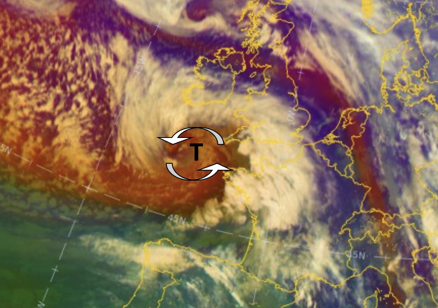
Fig. 3: Position of the low at 21:00 on Wednesday evening; Source: MeteoNews / UBIMET
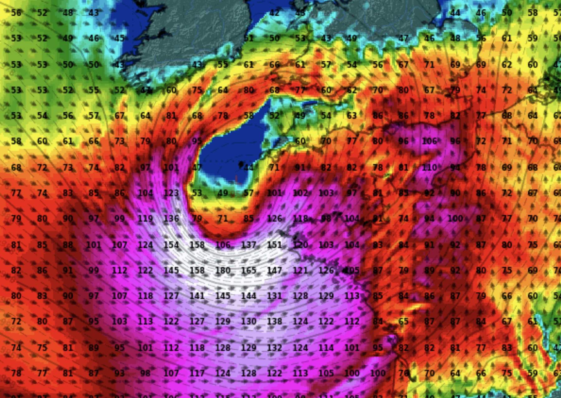
Fig. 4: In the night to Thursday the wind reaches the maximum with up to 180 km/h.; Source: MeteoNews AG / UBIMET
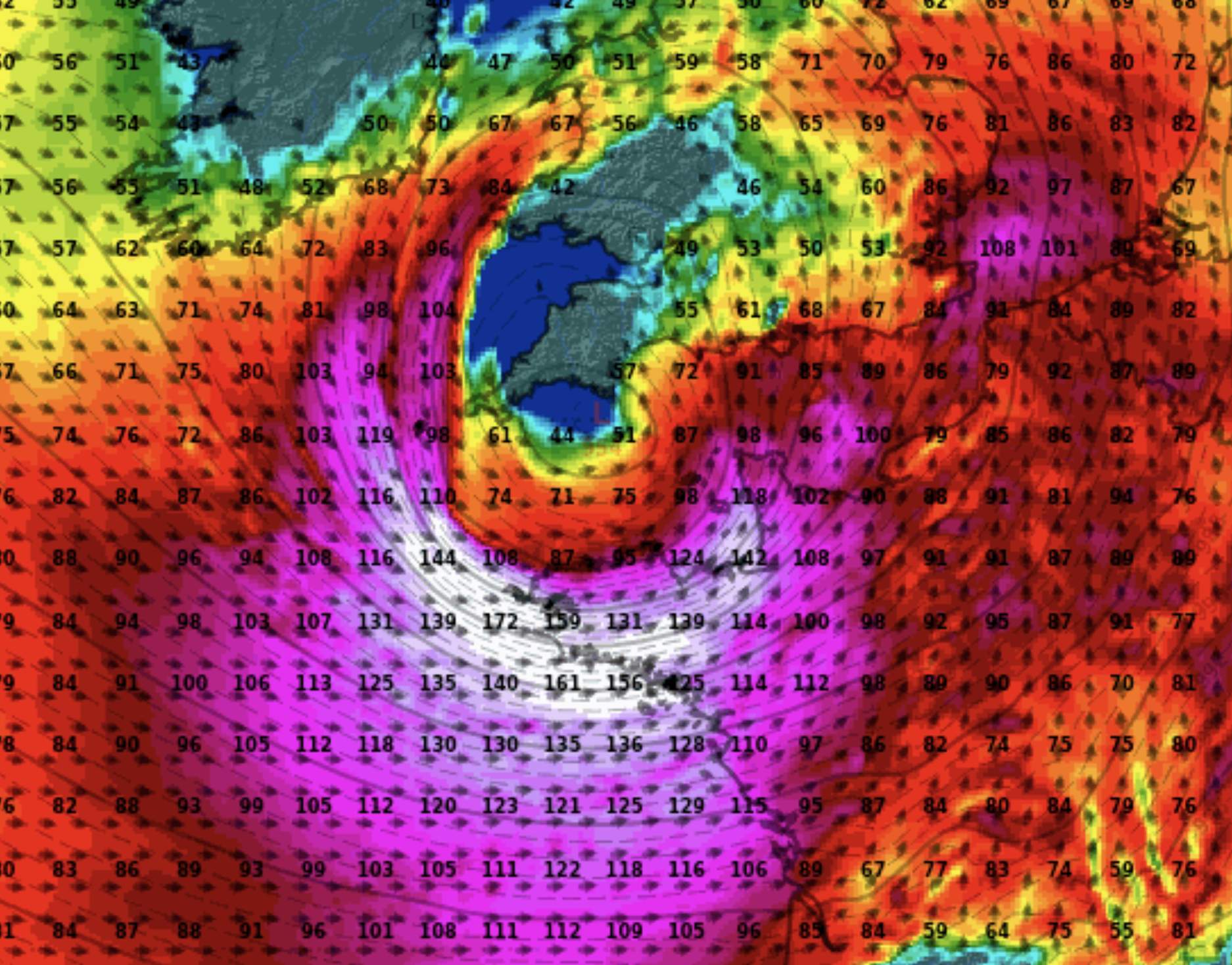
Fig. 5: In Brittany, the wind maximum is reached in the second half of the night.; Source: MeteoNews / UBIMET
Further development on Thursday
Early Thursday morning, the storm will make landfall on the south coast of England, probably in the area between Exeter and Southampton. During the course of the day, the depression will move in a northeasterly direction towards the North Sea, gradually weakening. Then, especially the regions around the English Channel will be exposed to the strongest winds. Although the strengths that can be expected in Brittany during the night will then no longer be reached, gust peaks between 100 and 130 km/h can also be expected in large parts of England, northern France, Belgium, Luxembourg, the Netherlands and also in the west of Germany. In addition, storm surge is a problem along the coast, and waves can reach up to 7 meters in height even in the English Channel.
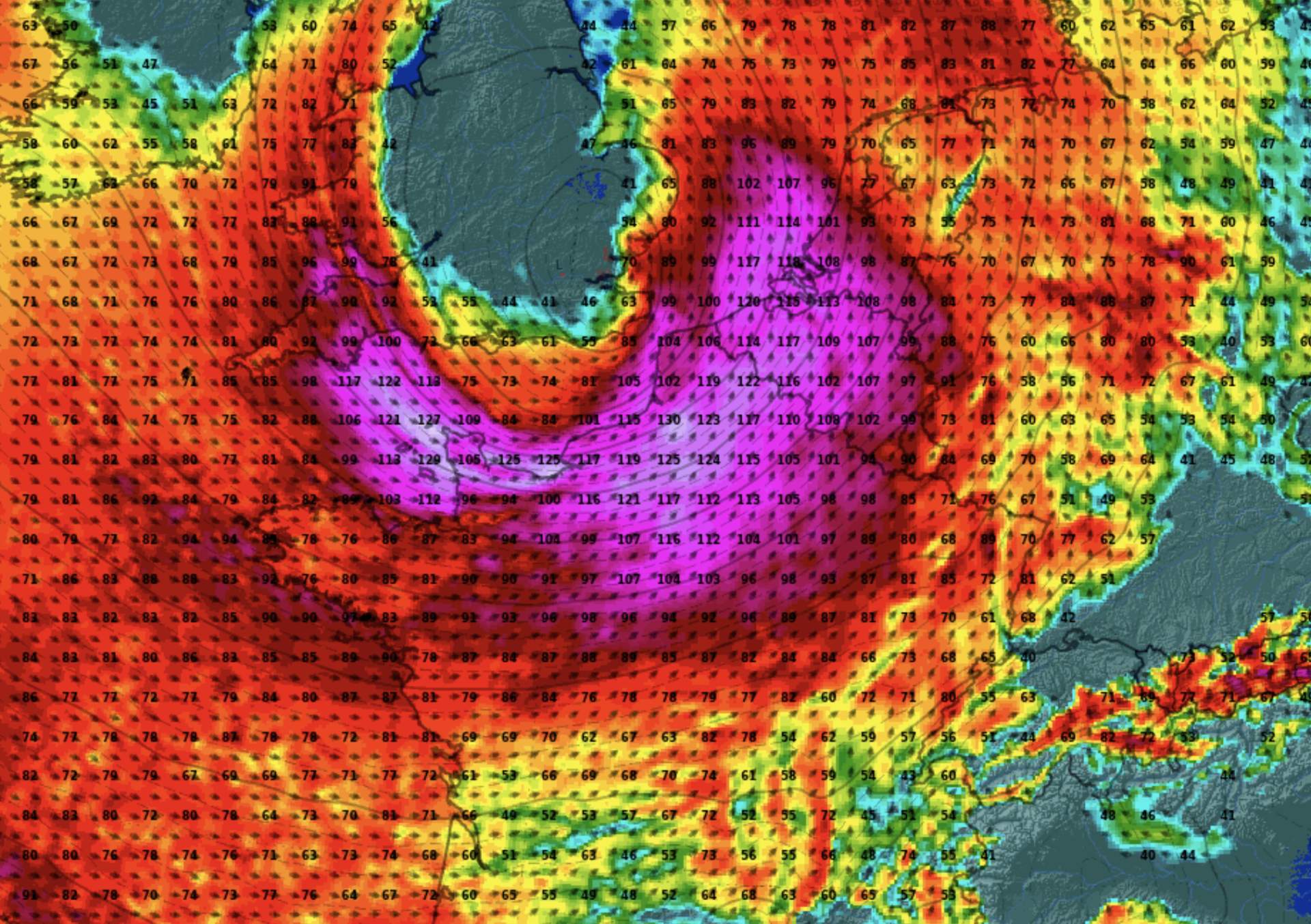
Fig. 6: Position of the low at noon on Thursday; Source: MeteoNews / UBIMET
We inform at this point continuously with further updates.
Gale-force winds roar from the Atlantic across southern England to the North Sea
Already in the last days quite strong lows lay over Great Britain and brought partly strong winds, now tomorrow Wednesday in the course of the day a big storm forms over the East Atlantic under very fast reinforcement, which subsequently rushes in the night to Thursday across the Bay of Biscay to the South of England and further to the North Sea. There is a threat of severe storm damage, especially in Brittany and southern England. On Thursday morning, the storm lies over southern England with a core pressure of a remarkably low 954 hPa (see Fig. 1).
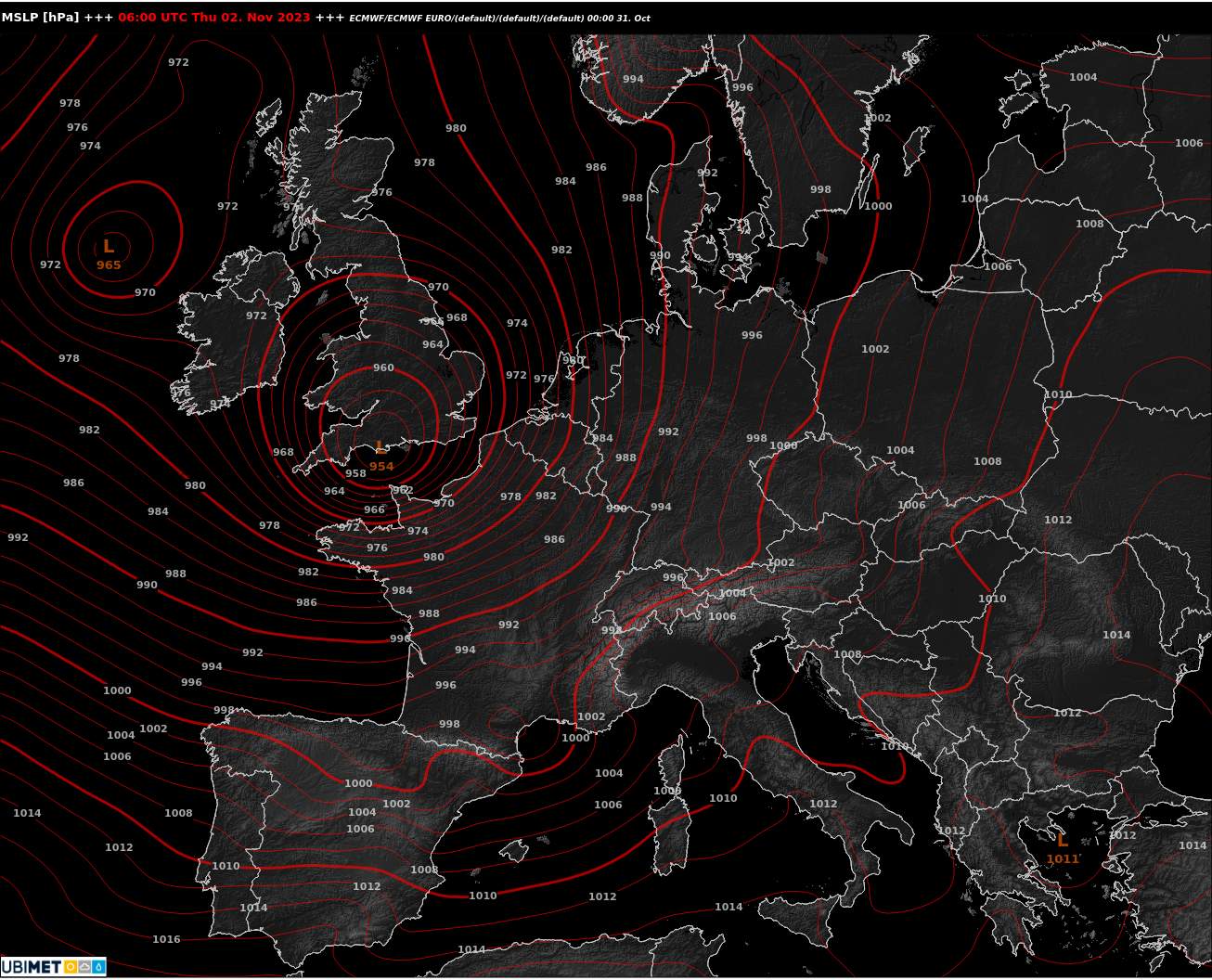
Fig. 1: Thursday morning Ciarán over southern England (European weather model ECMWF); Source: MeteoNews, UBIMET
Gusts of 130 to 180 km/h
In the following, the track of the storm with its associated gusts will be examined in more detail. Tomorrow evening, the depression will be located off the southwestern tip of England and will bring gusts of up to about 180 km/h in the open Atlantic; gusts of about 110 to over 130 km/h can be expected along the coast of northern France, but also of northern Spain (cf. Fig. 2).
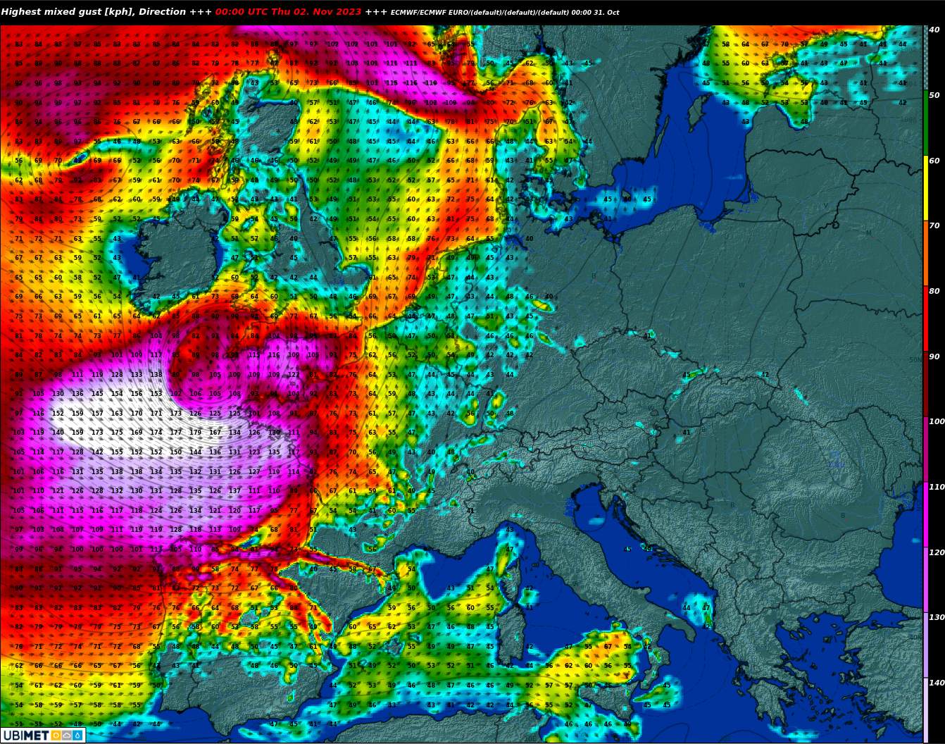
Fig. 2: Gusts Thursday night; Source: MeteoNews, UBIMET
Until Thursday morning, the low will move towards southern England, the winds will be somewhat higher at the coasts, gusts of more than 160 km/h are possible at the western tip of Brittany! In the English Channel, gusts of about 110 to 130 km/h can be expected in many places, locally also somewhat more (see Fig. 3).
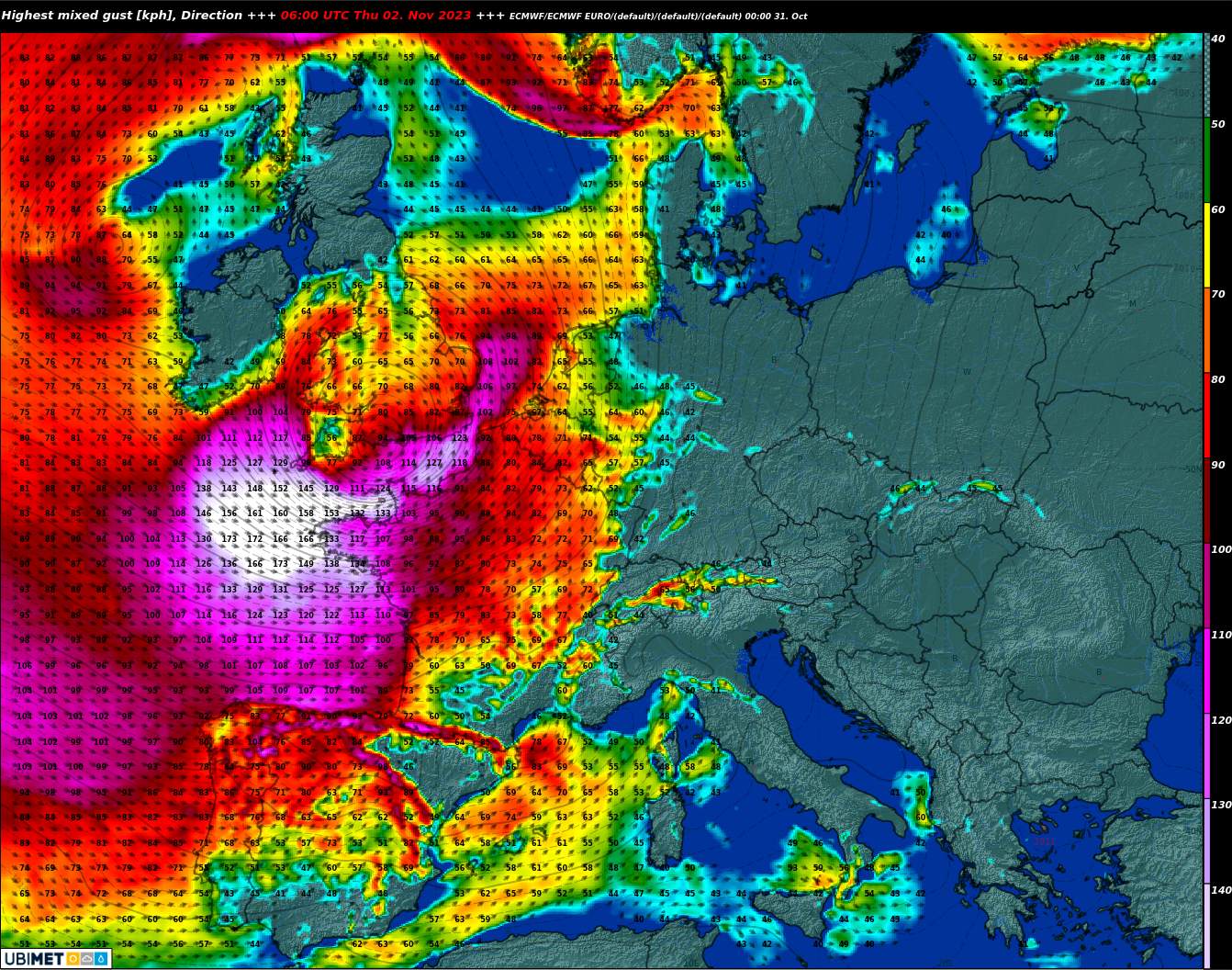
Fig. 3: Gusts Thursday morning; Source: MeteoNews, UBIMET
By Thursday evening, the depression will shift to the North Sea, weakening slightly, and during the day will bring gusts of about 100 to 130 km/h to the coasts of northern France, southern England, the Benelux countries and the East Frisian Islands, locally also more (see Fig. 4).
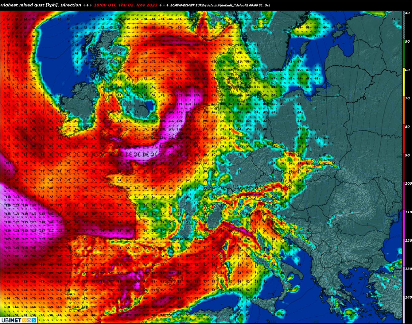
Fig. 4: Gusts Thursday day; Source: MeteoNews, UBIMET
On its further path in the Baltic Sea, the depression then loses further strength; on the North Frisian Islands and in Denmark, the gusts should then be below 100 km/h.
In addition to gale-force winds, high waves expected in some places
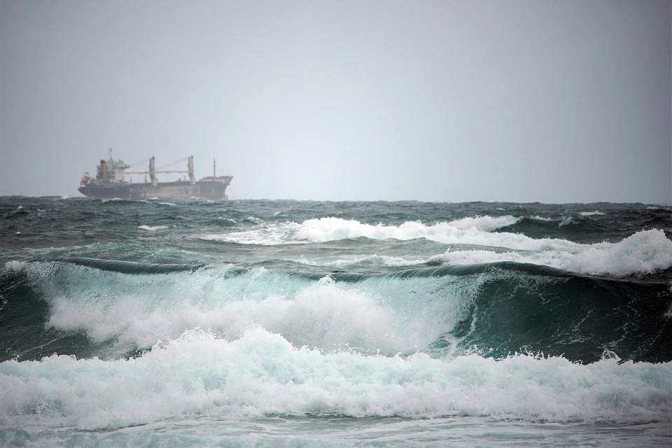
On the west coast of France and along the western English Channel, wave heights of up to more than 10 meters are locally possible (see Figs. 5 and 6), which may lead to flooding of coastal areas in some places. In addition, a lot of precipitation comes down, up to about 100 mm are possible.
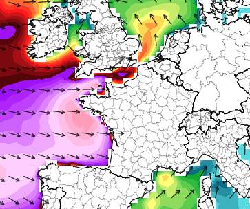
Fig. 5: Wave height on Thursday (pink about 10 meters); Source: tropicaltidbids
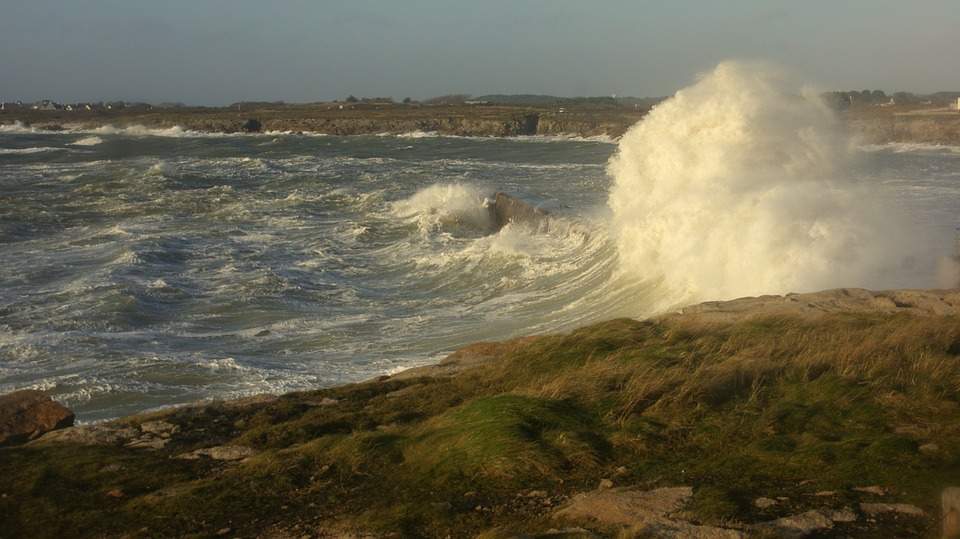
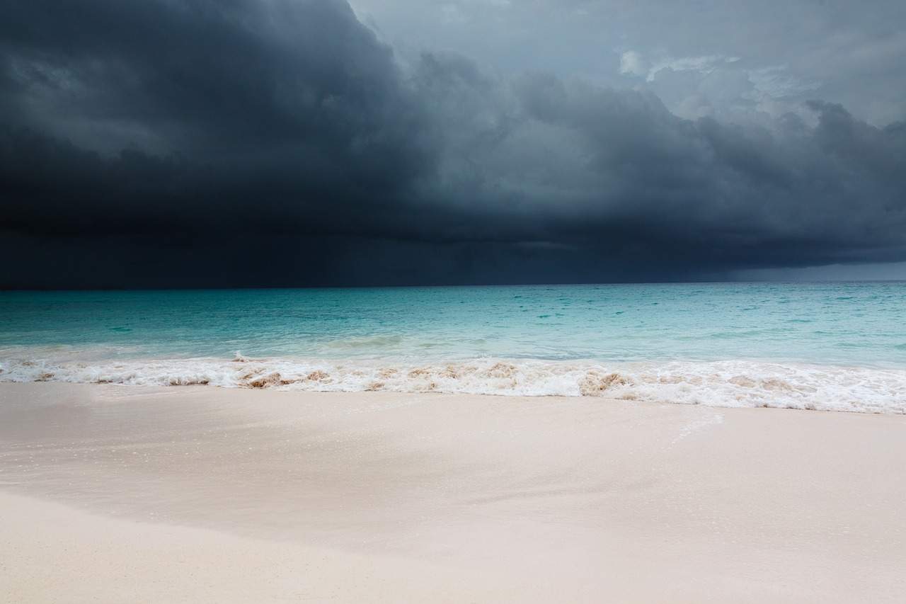
Fig. 6: Meter-high waves crash against the coasts of Brittany; Source: pixabay
Further storm lows in sight
During Friday night, a marginal low pressure system of Ciarán will reach the coasts of northern Spain, with gusts of about 100 to 130 km/h. Afterwards, it will remain stormy at times, especially on the coasts of Western Europe, because further lows will move from the Atlantic to Great Britain.
Switzerland only marginally affected
Switzerland is located on the southeast flank of the low pressure system. Besides short stormy foehn phases on Thursday and Saturday, there will be partly brisk westerly winds in the swiss plateau with gusts between 50 and 70 km/h, partly even more. On the mountains, stormy throughout, with over 100 km/h expected in exposed summit and ridge locations (see also here).
disclaimer
The content of this article has been at least partially computer translated from another language. Therefore, grammatical errors or inaccuracies are possible. Please note that the original language version of the article should be considered authoritative.

