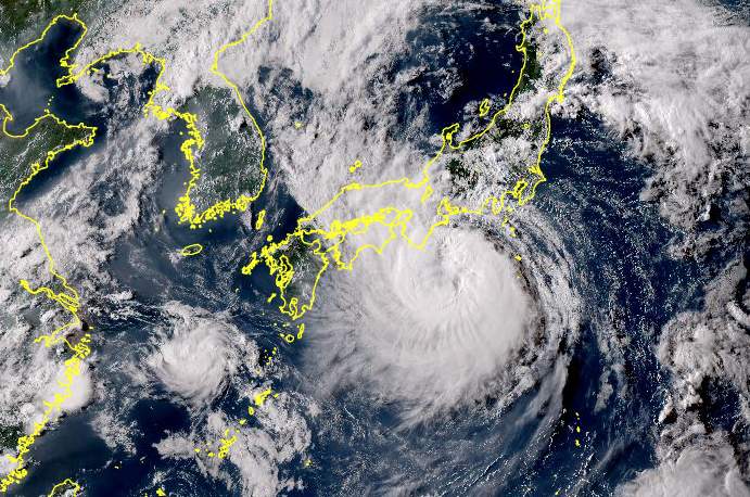
As every year, the hurricane season in the Atlantic officially starts on June 1. In the meantime, the first institutes have already published their forecasts for the course of the coming storm season, and they all see a very active course. The reason for this is a combination of two factors that are likely to complement each other almost perfectly this year.

JUNE 1 TO NOVEMBER 30
As mentioned above, the season does not officially start until June 1, but the NHC (National Hurricane Center) begins monitoring and regular publications on May 15. It lasts until November 30. On average, 14 named storms developed in the course of a season between 1991 and 2020, 7 of which were hurricanes, 3 of which were strong hurricanes of category 3 or higher. The names already defined are
|
|
|
|
|
|
|
|
|
|
|
|
|
|
|
|
|
|
|
|
|
Exceptionally high water temperatures
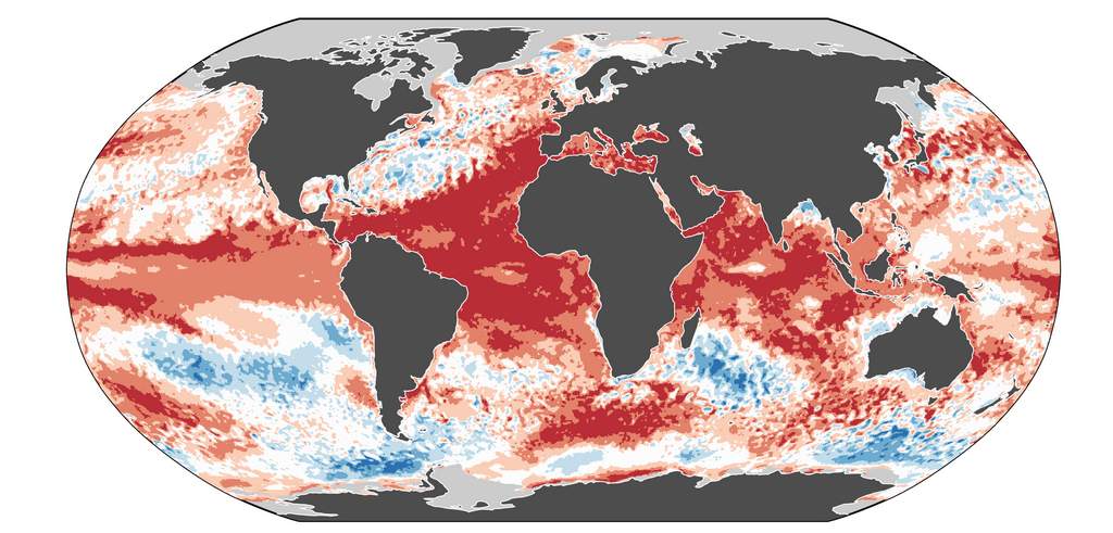
The sea surface temperature in the North Atlantic is currently warmer than average; more precisely, the anomaly has been at an absolute record level for over a year now! Since the beginning of March 2023, the average surface temperature has been higher on every single day than on any other year since 1981 (same calendar day). So far, 2024 has even beaten the record year 2023; in this respect, both years really are in a league of their own.

Fig. 1: Average sea surface temperature in the North Atlantic compared with the years since 1981; Source: climatereanalyzer

Fig. 2: Current anomaly in global sea surface temperature; Source: climatereanalyzer
El Niño conditions have prevailed in the equatorial Pacific in recent months, and this is still the case at present. However, the positive anomaly has already weakened significantly and temperatures are falling.
El Niño is going, La Niña is coming
At the end of January, we already dealt with the tipping ENSO swing here, and since then the signs have become stronger and the forecasts have been confirmed. We are still in an El Niño, but already in the absolute final stage. In the next three months, a neutral state is very likely to set in, after which ENSO will switch to La Niña – i.e. the cool side over the course of the summer. At the peak of the hurricane season between August and October (September is typically the strongest month, with a statistical peak around September 10), the models see La Niña conditions with an over 80% probability. Why is this important?

Fig. 3: Probabilities for the further ENSO development in the coming months (as of March 19); Source: IRI

Fig. 4: Current ENSO forecasts of the various computer models for the coming months (as of March 19); Source: IRI
History clearly shows that years with La Niña often have an active hurricane season in the Atlantic basin. So this year, two reinforcing factors come together almost perfectly – exceptionally warm surface waters in the Atlantic (the engine for tropical storms), and La Niña (which improves conditions in the atmosphere above).
Forecasts
Current forecasts are available from Tropical Storm Risk (TSR), the University of Arizona (UA) and Colorado State University (CSU). Tropical Storm Risk updated and increased its initial forecast of December 11, 2023 the day before yesterday.
| Source | Date of the forecast | Named storms | hurricanes | strong hurricanes |
| TSR | December 11, 2023 | 20 | 9 | 4 |
| CSU | April 4, 2024 | 23 | 11 | 5 |
| TSR | April 8, 2024 | 23 | 11 | 5 |
| UA | April 8, 2024 | 23 | 11 | 5 |
These first three institutes agree that the coming hurricane season will be hyperactive with 23 named storms. The record holder is 2020 with 30 named storms, ahead of 2006 with 28. 2024 would then be in third place with 23 named tropical storms. Once the forecasts from Accu Weather and the NOAA have been published, an update will follow here. We will also provide information here on any other developments, such as the first storm.
Haftungsausschluss
Der Inhalt dieses Artikels wurde mindestens teilweise computerunterstützt aus einer anderen Sprache übersetzt. Deshalb sind grammatikalische Fehler oder Ungenauigkeiten möglich. Bitte beachten Sie, dass die ursprüngliche Sprachversion des Artikels als massgeblich angesehen werden sollte.